
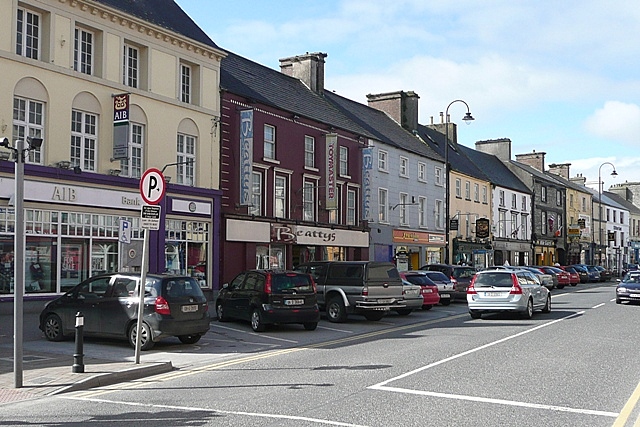
If you live in or around Loughrea, the walk to your nearest bus stop is longer than anywhere else in Galway. New figures from the Central Statistics Office show that the typical household in the Loughrea area is 3.3km from its nearest public transport stop, more than ten times the distance faced by people in Galway city.
The data, published by the CSO on Wednesday 28 October and broken down for Galway by Galway Bay FM, paints a stark picture of the divide between the city and much of the county when it comes to getting around without a car.
How every part of Galway compares
According to Galway Bay FM’s analysis of the CSO figures, the distance to the nearest public transport stop in each part of the county is as follows:
- Loughrea: 3.3km
- Connemara North: 2.2km
- Ballinasloe: 1.9km
- Gort-Kinvara: 1.8km
- Connemara South: 1.6km
- Athenry-Oranmore: about 1.3km
- Tuam: about 1.2km
- Galway City: 300 metres
Perhaps the biggest surprise is that the Loughrea area, a busy market town in east Galway, ranks behind the remote parts of north Connemara. South Connemara, home to the Gaeltacht villages along the coast road from An Spidéal to An Cheathrú Rua, comes in well ahead of both, at 1.6km, which is 600 metres closer than the north of the region.
Tuam and Athenry-Oranmore, both on busy commuter routes into the city, record the shortest distances outside Galway city itself.
Fill-up shock: Galway drivers face long trip to the pumps
The CSO also measured how far households have to travel to reach a fuel station, and here Galway county does not fare well either. Galway Bay FM reported that the typical household in County Galway is 3km from a service station, further than neighbouring Mayo at 2.6km, Clare at 1.8km and Tipperary at 1.5km.
Nationally, the CSO found that half of all households are within 1.4km of a fuel station. Leitrim is the worst-served county, where half of households are more than 6.5km from the nearest pump, according to the CSO and TheJournal.ie.
The national picture
Across the country, about eight in ten households are within 2km of a bus stop, but that falls to 68% when only high-frequency stops are counted, RTÉ and TheJournal.ie reported. The CSO defines a high-frequency stop as one served ten or more times between 6am and 8pm on a weekday.
Roscommon households are the furthest from public transport stops of any county, with a median distance of 2.1km to any bus stop and just over 7km to a high-frequency one. In Dublin, by contrast, the median is 300 metres. Rail access is far patchier: half of households nationally are within about 5.5km of a rail stop, but a quarter are more than 15km away, RTÉ reported, and Donegal, Monaghan and Cavan have no stations at all.
The CSO’s figures are based on Census 2022 household locations mapped against transport and service data.
What it means for you
For people in east Galway and north Connemara without a car, these distances can decide whether a hospital appointment, a college course or a job in the city is realistic. For those who do drive, the longer trips to fuel stations add to running costs at a time when pump prices are high.
The figures are also likely to be seized on by local representatives who have been pushing for more rural bus routes and better rail services in the county.
What happens next
The CSO’s release is part of a wider series measuring how far Irish households live from key services. The National Transport Authority continues to roll out new routes under its Connecting Ireland rural transport plan, and councillors and TDs in Loughrea, Ballinasloe and north Connemara are likely to use the new figures to argue for their areas to be prioritised. Readers can check the full figures on the CSO website.
Sources
- Galway Bay FM: Loughrea furthest from public transport stops in Galway (29 October 2026)
- Central Statistics Office: Measuring Distance to Services in Ireland 2026 – Transport Services (28 October 2026)
- RTÉ News: 68% of households within 2km of high-frequency bus stop (28 October 2026)
- TheJournal.ie: How far is your nearest bus stop? For most of us, it’s apparently 2km or less (28 October 2026)
Featured image: Loughrea, Main Street by Graham Horn, CC BY-SA 2.0, via Wikimedia Commons.
Leave a Reply